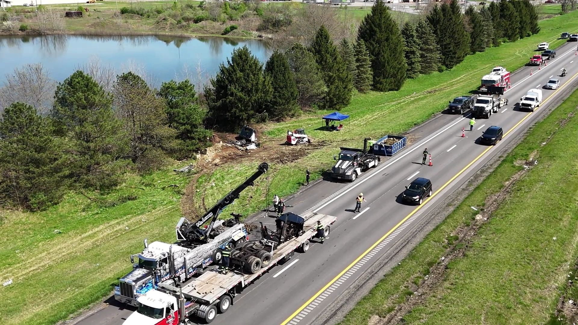
We capture The Data You Need to be Successful in The Courtroom
Our team is committed to leveraging cutting-edge technology and expertise to deliver comprehensive and accurate aerial data collection, analysis, and documentation. Through meticulous aerial surveys, high-resolution imagery, and advanced 3D modeling, we aim to assist forensic investigators, insurance agencies, and legal professionals in reconstructing accidents with precision and detail.
Our state-of-the-art aerial imaging equipment captures detailed images and videos from various angles, allowing for comprehensive reconstruction and accurate assessments. We combine our advanced data processing techniques with extensive industry knowledge to deliver unparalleled results, empowering investigators, legal professionals, and insurance companies with critical evidence for their accident investigations. Choose Aerial Visual Technologies for unmatched aerial imagery and data that sets the standard for excellence in accident reconstruction.
Our cutting-edge approach combines the power of AutoCAD, Civil 3D, point clouds, 3D models, real-time orthomosaic maps, and 6K aerial video to provide you with the most comprehensive and detailed insights. With our advanced RTK (Real-Time Kinematic) technology, we ensure centimeter-level accuracy, enabling precise measurements and analysis. Trust us to capture and deliver the highest quality drone data, giving you the critical information you need for a thorough accident reconstruction.
At Aerial Visual Technologies, we take pride in our team of highly skilled and specialized drone pilots who excel in capturing aerial data for accidents occurring on interstates, state routes, and general roadways. Their expertise ensures precise and comprehensive data collection, enabling accurate accident investigation and reconstruction. We are committed to excellence in every aspect of our work, going above and beyond to deliver exceptional results. Furthermore, we have partnered with Krucial Engineering, a renowned mechanical engineering firm, to leverage their expertise and combine it with our aerial data. This collaboration results in the ultimate synergy of accident investigation, documentation, and reconstruction, providing you with a comprehensive and insightful perspective on each incident.
Please reach us at flywithavt@avtdrones.com if you cannot find an answer to your question.
Drone surveys over active road and highway sites where ground control points cannot be used can still achieve remarkable accuracy through the use of RTK (Real-Time Kinematic) drones. By leveraging RTK capabilities, our drones can capture highly accurate (centimeter-level) data even in challenging environments without the need for physical ground control points. This ensures that our surveys deliver exceptional precision and reliability, making them an ideal solution for obtaining accurate measurements and detailed information for road and highway sites.
Good news! We process all of our data in-house which allows us to provide unbelievable turn-around times. The average project consisting of 500 photos or less generally takes 24-48hrs to provide an Ortho, 3D Model, Point Cloud and multiple other beneficial files that will assist your attorney or forensic investigator in building a dynamic case. CAD drawings may take additional time depending upon the accident site complexity.
At Aerial Visual Technologies, we pride ourselves on providing tailored solutions to our clients, which is why we do not rely on cookie-cutter software like Drone Deploy or Pix4D. Instead, our team utilizes specialized software such as Civil 3D, AutoCAD, and other Autodesk products. This approach allows us to create customized deliverables that are perfectly suited to the unique requirements of each accident reconstruction case. By leveraging the power of these advanced software tools, we can deliver precise and detailed outputs, ensuring that our clients receive the most accurate and comprehensive analysis for their specific needs.
While the ultimate decision is up the court of jurisdiction to keep in, or out certain types of evidence, there are numerous cases that have been won or lost based on UAV data. Please refer to our white paper under the information tab for a more through understanding.
Copyright © 2022 AVT Drones- All Rights Reserved.
We use cookies to analyze website traffic and optimize your website experience. By accepting our use of cookies, your data will be aggregated with all other user data.